

Mt Elbert – Colorado Highpoint
San Isabel National Forest, Colorado
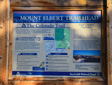
Mount Elbert, the highest peak in Colorado, rises to 14,433 feet in elevation—making it not only the state highpoint, but also the second highest mountain in the Lower 48—only Mount Whitney in California is higher.
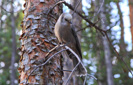
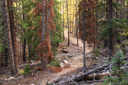
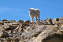
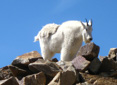
The North Mt Elbert Trail, the access route preferred by the Colorado Fourteeners Initiative (CFI), climbs steeply through lodgepole and spruce-fir forest populated by curious gray jays, and across alpine tundra punctuated by the occasional marmot, pika, or mountain goat, before arriving at the summit—4.5 miles from the trailhead.
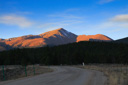
We began our hike at 7:30am on a beautiful, crisp September morning—the mercury was hovering around 29°F and there was 0% chance of precipitation for the day, allowing us to sleep in more than usual for such a climb. No alpine start for us, yay.
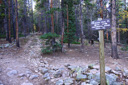
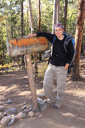
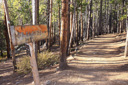
From the well-marked trailhead, the first section of the hike starts out by following a gentle grade along the Colorado Trail through lodgepole pines—in just a few minutes, 0.1-mile from the parking area, you will reach a trail junction marking the intersection of the Colorado Trail and the Continental Divide Trail, continue hiking along the Colorado Trail for the next mile to another sign marking the departure of the North Mount Elbert Trail to the right.
 |
 |
 |
This route, though steep…and I mean steep…is the easiest and poses no special problems for the hiker, but it is not to be underestimated either—it’s imperative to leave no later than 6:30am (during summer months) to avoid afternoon thunderstorms and lightning, and most hikers should allow 8 to 10 hours for the 9-mile roundtrip.
 |
 |
 |
 |
|
 |
 |
 |
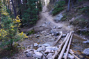
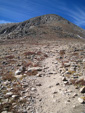
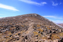
Continue climbing, now on the North Mt Elbert Trail, gaining nearly 4,000 feet of elevation in the remaining 3.2 miles—the elevation gain to this point is only 460 feet. The predominantly 20 degree slope rises to tree line at 12,000 feet in a no nonsense manner—forget about switchbacks, the trail heads straight up through the spruce-fir forest in earnest.
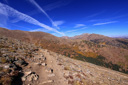
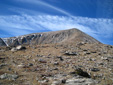
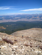
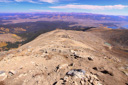
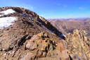
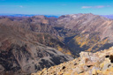
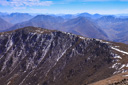
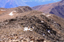
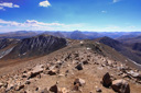
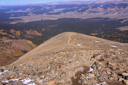
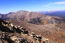
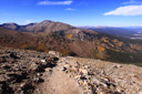
At mile 1.9, you reach the northeast ridge—a long, sloping ramp of granite flanked by Elbert Creek below its north side and Box Creek to the south. The top of the ridge is open and dramatic, providing the perfect platform for a trail—panoramic views of Mount Massive, the granite filled valley, and a glimpse of “the top” come into view. In a disappointing twist of fate, “the top” is merely a false summit (one of three)—once reached, the 13,880 foot outcrop reveals its dastardly secretly—the real summit rises 550 feet higher.
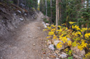
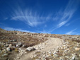
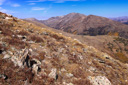
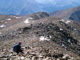
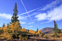
Along the ridge, the relentless climb continues as the trees dwindle to dwarfs—timberline, reached 2.4 miles from the trailhead, becomes a reality at 11,900 feet. Above treeline, the trail climbs through the barrenly beautiful world of the alpine tundra—tiny plants that are extremely fragile (please stay on the trail) dominate the boulder filled landscape. Various paintbrushes (Indian and sulfur), yellow alpine avens, old-man-of-the-mountain, and sky pilot brighten the surroundings in the summer season.
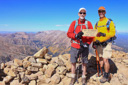
As we made our way up the steep ridge, we could see two hikers ahead of us just below the false summit—we were hiking late in the season and on a weekday, so the trail was relatively quiet. The two hikers stopped to take a break and were standing on the side of the trail as we began the process of leap-frogging our way up the final pitch of Mount Elbert—then, just as we were hiking past them, the coolest thing happened! One of the hikers recognized us from Natural Born Hikers—I swear we felt like celebrities! We stopped and talked with the hikers, two great guys from Colorado, before continuing our hike—meeting up with them, Mike and Stretch, once again on the top of Colorado.
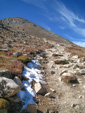
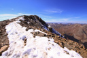
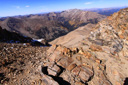
The unrelenting climb towards the summit is steepest along the west side of the first false summit—loose rocks, intermittent patches of snow, and a few big rock steps make this the most challenging section of the trail.
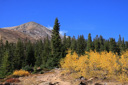
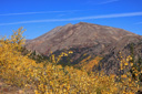
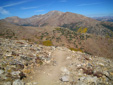
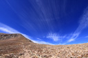
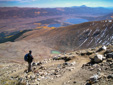
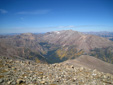
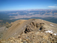
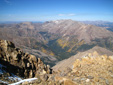
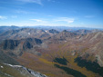
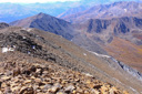
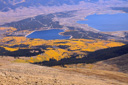
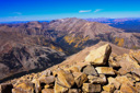
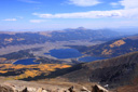
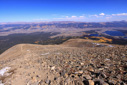
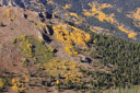
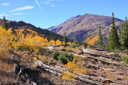
More views open up as you gain elevation, including striking vistas of the Twin Lakes and the Arkansas River Valley, which was glowing with the golden hues of fall colored aspen the day we summited the highpoint—bright blue skies with beautiful wispy clouds, temperatures in the mid 60’s, and an occasional brisk wind accompanied us through the breathtaking landscape.
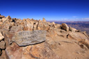
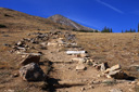
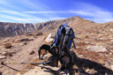
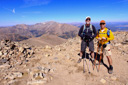
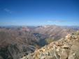
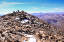
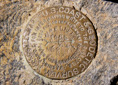
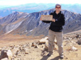
Mount Elbert levels out slightly near the summit, so you won’t be able to see the true summit until you are practically setting foot on the top—breathless, tired, and mentally weary from the frustration of two false summits, you finally crest 14,300 feet to see the actual summit. Rock shelters, a USGS benchmark, a 360 degree panorama of mountain peaks, and get this, a lone mountain goat, awaited us at the top of Colorado—what a sight!
We spent nearly an hour enjoying the highpoint, taking photos, and reuniting with our new friends, Mike and Stretch—before beginning the slow, painful, knee-jarring descent, putting as back to our car just around 5:30pm.
Our successful summit of Mount Elbert brings us to nine state highpoints—eight if you discount our unsuccessful bid for Idaho’s Borah Peak. Not only have we now summited the highest mountain in Colorado, we can include ourselves among those who have successfully climbed the highest and second highest mountains in the Continental United States—bring on number three, Mount Massive here we come…look for us on the trail one of these days!
 |
 |
 |
 |
 |
 |
 |
 |
 |
 |
 |
 |
 |
 |
 |
 |
 |
 |
 |
 |
 |
 |
 |
 |
 |
 |
 |
 |
 |
 |
 |
 |
 |
 |
 |
 |
 |
 |
 |
|
 |
 |
 |
 |
 |
 |
 |
 |
 |
 |
 |
 |