
Borah Peak—Idaho's Highpoint
Salmon-Challis National Forest, Idaho

Acrophobia is defined as an abnormal or pathological fear of heights—an irrational monster of the mind that turned me into a whimpering basket case on the slopes of Borah Peak, the highest mountain in the state of Idaho.
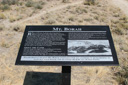
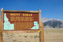
Borah Peak, or Mount Borah—whichever you prefer, rises to a height of 12,662 feet to claim the highest point in Idaho. The mountain towers some 5,250 feet above the Lost River Valley and provides the adventurous hiker with the ground to test their climbing mettle. The 7 mile roundtrip hike to the summit of Borah Peak is ranked as the sixth most difficult state highpoint to reach—mostly because the terrain is very steep, gaining nearly 5,400 feet in 3.5 miles, but also because the class 3 scramble along the appropriately named “Chicken Out Ridge” lends an airy exposure to this already lofty trek.
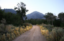
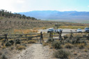
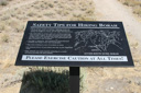
To test your courage and/or stamina, drive yourself to the “Mt Borah Trailhead” turnoff—located between mile markers 129 and 130 on the east side of US 93. There you will find five campsites, a few picnic tables, and a toilet (there is no water available)—not to mention the access to the traditional climbing route (Southwest Ridge Route). The elevation at the trailhead is 7,320 feet, leaving the climber with the task of climbing 5,342 feet along a very steep and strenuous trail.
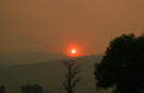
The chance to summit the highest peak in Idaho was an exciting prospect, especially when we heard about “Chicken Out Ridge”—an exposed knife-edged traverse near the top of the mountain, so we set off for the trailhead on August 26, 2007—the smoke from the Ketchum fire hanging in the air.
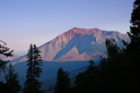
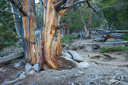
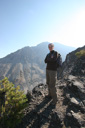
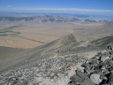
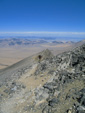
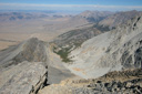
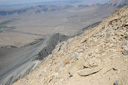
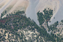
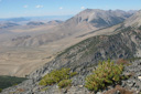
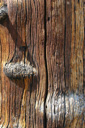
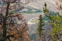
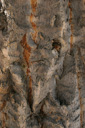
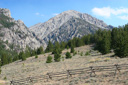
We took our first steps toward the summit at around 6:30 in the morning, fully expecting to spend 12 hours—the far end of the average hiking time of 6 to 12 hours—on the mountain. We contoured our way up the steep slope through sagebrush, weatherworn wood, and evergreens until we reached a point where we could see the Lost River Valley—the rising sun painting the plains with the rich colors of alpenglow.
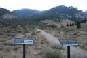
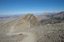
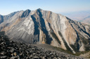
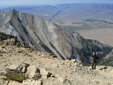
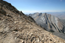
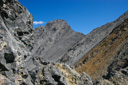
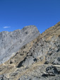
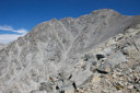
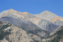
Onward we climbed, thankful for the trekking poles we had in hand, until finally, we emerged from tree line at 9,800 feet—the round, gray summit of Borah looms to the left, and the jagged 11,898-foot spur pierces the sky ahead. Just above timberline, the trail begins a series of switchbacks up a rocky promontory—the sun was just beginning to rise above the outcrop, which made it difficult to see very far ahead. Then, finally, the sun rose high enough to not interfere with our vision and we could see the spectacular mountain scenery—incomprehensibly panoramic views surrounded us in every direction—it’s all open sky from this point forward, especially when you reach the rocky, tundra-covered ridge crest.
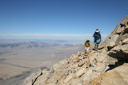
Just below ridge crest, we stopped for a snack—the time was 10:00 am. Several hikers passed us as we ate, and as always, we enjoyed conversing with the unique people found on the slopes of a mountain.
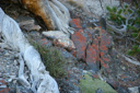
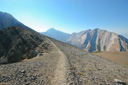
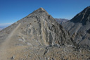
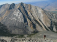
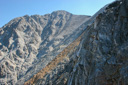
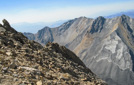
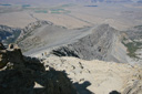
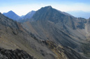
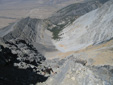
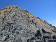
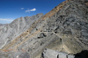
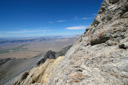
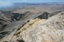
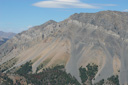
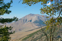
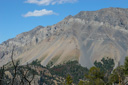
Ahead, the obvious trail continues through the magnificent landscape—we found this to be the most scenic portion of the hike—to the left is an uninterrupted cliff, dropping nearly 800 feet to the Rock Creek basin, and to the right, a talus field slopes gradually down into Cedar Canyon. Above Cedar Canyon rises Peak 11,308, a picturesque charcoal colored mountain with vertical streaks of orange—I think I took over 20 snapshots of this peak alone.
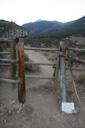
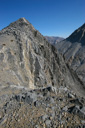
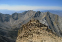
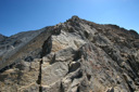
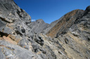
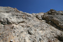
The further we climbed up the ridge crest, the fainter the trail became—a sure sign that we were getting closer to “Chicken Out Ridge (COR).” As the path became rockier, it became more difficult to choose the route—rock cairns were scarce, and most of the other climbers on the mountain were far ahead of us—so, no one to follow either. In the end, you must judge for yourself the best route and how much exposure you can manage— so far I was okay.
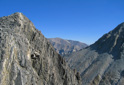
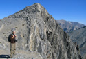
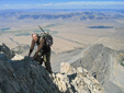
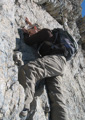
Near 11,700 feet we climbed onto COR—from this moment onward, my adrenaline was rising. The first section was for me, extremely intimidating, but I made it across the knife-edge with no problems other than shaky knees. Even though I had surmounted one obstacle, it seemed my acrophobia was kicking in, and I was beginning to question my ability to reach the summit, but onward I climbed.
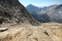
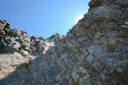
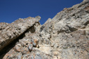
Soon, we found ourselves below the ridge crest on the north side of COR—we were following a proper trail, interspersed with some class 3 scrambling. Eventually, the trail became non-existent and we were left with the task of climbing a steep, couloir filled with loose rock. We managed to climb the chimney-like formation, hoping throughout that when we reached the top we would be in a position to best judge our next move—we had no way of knowing if we were headed in the right direction. From our vantage point at the beginning of the climb, we could see the summit block of Borah Peak and two hikers on the flat trail running along the spur—we yelled to them to ask if we were headed in the right direction and they responded that we were—our confidence bolstered, we continued.
Making our way up the rock slab required the use of handholds to ascend, and the loose rock made footholds precarious. Nonetheless, we made it to the top where we found ourselves close to the infamous Borah Peak down-climb. For many people, COR barely raises their blood pressure, but for those of us with that creeping fear of exposure, this section is gut-wrenching—unfortunately for me, my fear (which manifests only under certain circumstances) was getting the best of me. The thought of climbing back the way we had just came literally terrified me, not to mention the fact that I was still facing the down-climb—the crux of the entire route.
The down-climb, an awkward third class maneuver where you lower yourself feet first, face to the rock, down a 15 foot cliff, normally deposits you on a snow bridge—the snow had completely melted by late August of 2007. According to those in the know, the down-climb is the last problem on the ascent, and it was a problem I could not overcome. No matter how hard I tried to talk myself into taking that step of faith, my mind would not allow it—the fear got the best of me. Dejected, I resigned myself to the fact that I had come as far as I was going to go on Borah Peak—I watched with envy as those already on the summit proudly waved the flag. We were probably only 800 feet below the summit and approximately 90 minutes away—it was noon when we reached the down-climb—so close, yet so far away. Nothing wrecks a romp in the mountains quicker than the agony of defeat, and despite trying to convince myself that I could do this for nearly 30 minutes, defeated I remained. Heartbroken and apprehensive about the trek back across COR, I left my dreams of summiting Borah Peak behind and focused on the return trip—turning back at 12:30 pm.
On the return, we followed our footsteps down the couloir and back to the broken trail until reaching the first portion of COR—at this point, we switched over to the south side of the ridge and tackled the knife-edge from a different angle. This turned out to be as exposed as our ascent, leaving us clinging to a cliff-face for our final experience on “Chicken Out Ridge.” We made our way across the cloud-piercing crest until we were safely descending the well-worn and less exposed cliff-side trail.
As summit fever faded from our consciousness, we once again began to enjoy the beauty that is the tallest mountain in the Lost River Range. Retracing our steps back down the slopes gave us a chance to appreciate the pristine alpine scenery once more, and before we knew it we were back at the trailhead enjoying a cold beverage from the cooler in our car—the time was 4:30 pm. We had spent ten hours on Mount Borah, and despite the initial, and to be honest, the residual disappointment of not reaching the summit, we enjoyed every minute of the climb—even the knee punishing descent. Maybe one day I will return to Borah to test my courage, but until then I am thankful for the fun day I spent on an incredible mountain.
 |
 |
 |
 |
 |
 |
 |
 |
 |
 |
 |
 |
 |
 |
 |
 |
 |
 |
 |
 |
 |
 |
 |
 |
 |
 |
 |
 |
 |
 |
 |
 |
 |
 |
 |
 |
 |
 |
 |
 |
 |
 |
 |
 |
 |
 |
 |
 |
 |
 |
 |
 |
 |
 |
 |
 |
 |
 |
 |
 |