
Skyline Divide Trail
Mount Baker-Snoqualmie National Forest, Washington

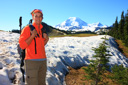
Forested miles of evergreens, high alpine meadows chock full of summer wildflowers, and an in your face view of Massive Mount Baker await on this spectacular 10-mile roundtrip hike—this is the Skyline Divide Trail.
 |
 |
 |
 |
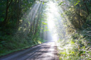
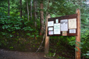
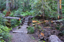
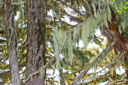
From the trailhead, located at the end of FR 37 off Glacier Creek Road, climb through second-growth firs and hemlocks for about 2-miles —the climb utilizes steep switchbacks, so be prepared for burning quads and heavy breathing. Despite the fact that the trail begins at an already respectable elevation, around 4400 feet, you will find yourself gaining just over 1400 feet in the first two miles—nearly another 700 feet will be gained after attaining the ridge.
 |
 |
 |
 |
 |
 |
 |
 |
 |
 |
 |
 |
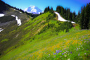
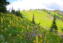
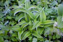
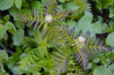
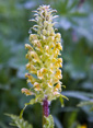
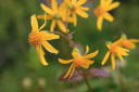
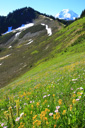
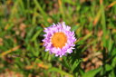
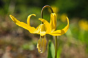
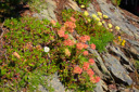
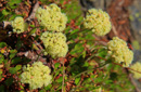
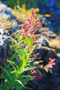
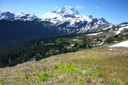
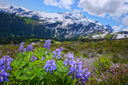
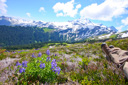
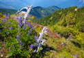
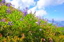
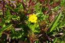
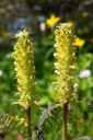
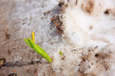
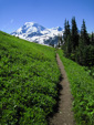
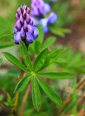
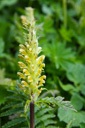
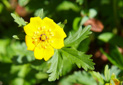
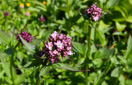
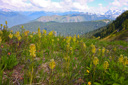
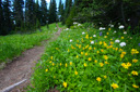
At about the 1-mile mark the trail levels off for a brief stretch, but regains ascending long before you have rested your legs—keep your mind off the climb by studying the pocket meadows for wildflowers such as Mountain arnica, Columbia tiger lily, glacier lily, lupine, bracted lousewort, valerian, and false hellebore.
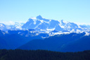
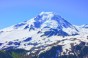
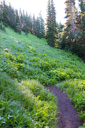
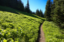
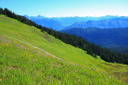
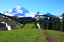
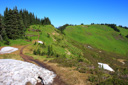
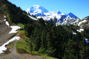
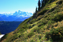
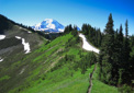
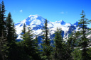
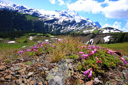
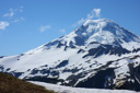
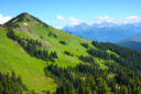
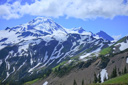
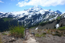
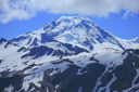
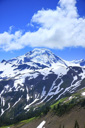
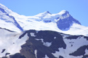
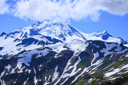
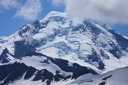
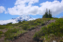
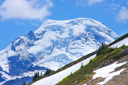
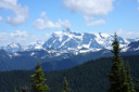
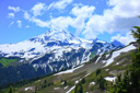
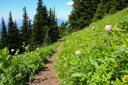
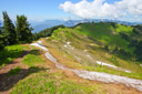
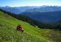
At 2 miles, you will exit the forest and emerge on the open ridge of Skyline Divide—more than likely, you will be greeted with patches of snow, resplendent meadows, and a view of 10,781 ft Mount Baker that will knock your Smartwools off!
 |
 |
 |
 |
 |
 |
 |
 |
 |
 |
 |
 |
 |
 |
 |
 |
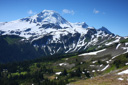
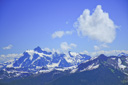
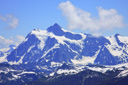
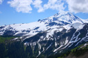
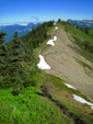
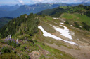
Continue following the ridge trail, admiring not only the views of Mount Baker but also Mount Shuksan to the southeast—at this lofty 6000 foot elevation, on a clear day, you can also see the San Juan Islands to the west, Vancouver Island to the north, and the peaks of the Olympic range to the south. You might also see, or at least think you see, Julie Andrews spinning through the meadows a la “The Sound of Music”—hands up, who knows the words to Climb Ev’ry Mountain?
 |
 |
 |
 |
 |
 |
 |
 |
 |
 |
 |
 |
 |
 |
 |
 |
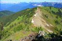
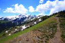
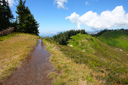
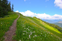
After gaining the crest of the ridge, head towards the prominent knoll just left (east) of the main trail—the spur trail, located at the 2.75-mile mark, gains approximately 200 feet and affords excellent views of Mount Baker and the trail’s route. If you don’t have the stamina for this climb, don’t sweat it, the views are just as grand further along the main trail—views that are acquired with less effort.
 |
 |
 |
 |
 |
 |
 |
 |
 |
 |
 |
 |
 |
 |
 |
 |
 |
 |
 |
 |
 |
 |
 |
 |
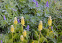
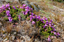
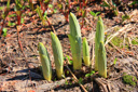
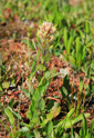
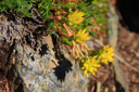
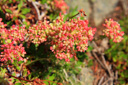
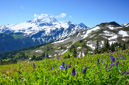
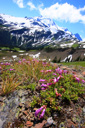
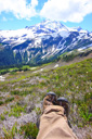
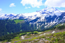
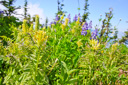
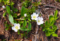
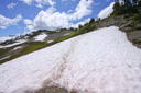
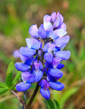
The decision to climb the knoll or skip the ascent, is up to you, but either way you must make the effort to reach the saddle below Chowder Ridge—upon reaching a fork in the trail (located past the knoll) at mile 3.5, take a right and climb along the ridge as far as your legs and the snow will allow. That little voice inside your head will likely be chanting, “Just go a little bit farther”, especially when that snow-covered celestial body exerts its pull on your psyche—how far you actually go is up to you. We decided to turn around at about the 5-mile mark, after enjoying a hiker’s lunch along the ridge amid Indian paintbrush, white paintbrush, lupine, penstemon, glacier lilies, and American bistort—all in the shadow of a jaw-dropping volcano.
 |
 |
 |
 |
|
 |
 |
 |
 |
 |
 |
 |
 |
 |
 |
 |