
Emory Peak
Big Bend National Park, Texas

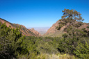
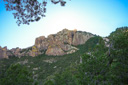
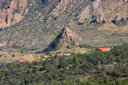
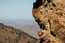
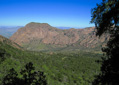
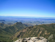
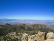
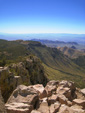
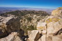
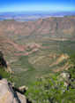
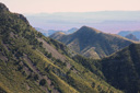
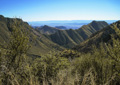
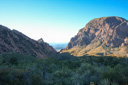
Emory Peak, the highest mountain in Big Bend National Park, is a rocky promontory granting those who climb to its summit magnificent views of the Chihuahuan Desert rolled out below the numerous peaks of the mountains of the Chisos range. On a clear day, you can see for miles in all directions—vast stretches of uninhabited land spread out below the peak—life appears to be absent, but in reality, life is everywhere.
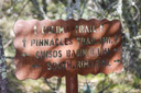
Two different trails lead to the 7,825-foot mountain—the Pinnacles Trail/Boot Canyon Trail and the Laguna Meadow Trail—combining the two routes via the Colima Trail to form a 12-mile loop makes for a great dayhike. Originally, we had just planned to hike to the peak by the Pinnacles Trail, catch the 1-mile spur trail and then return along the same route, but we were having so much fun that we decided to extend our hike via the loop described above—a good choice as it turned out.
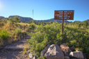
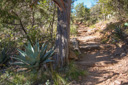
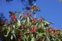
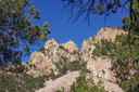
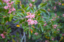
The Pinnacles Trail climbs into the Chisos Mountains from the Basin, passing through oaks, pines, junipers and Texas madrone trees to a high saddle between Toll Mountain and Emory Peak. Classed as a strenuous dayhike, this 6.3-mile one-way trail leads from the Basin Trailhead to the South Rim—if your goal is Emory Peak, the spur trail (2 miles roundtrip) that leads to the summit lies 3.5 miles down the trail—a 9-mile roundtrip hike if you return the way you came. However, if you continue along the Pinnacles Trail after summiting Emory Peak, you will get to enjoy the amazing views of Boot Canyon—something we are glad we did not miss.
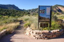
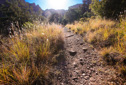
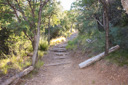
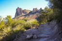
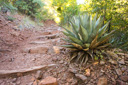
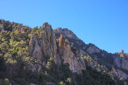
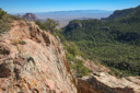
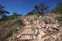
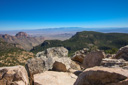
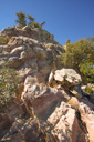
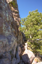
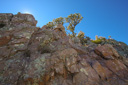
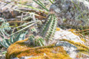
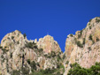
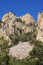
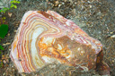
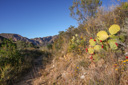
The night before our hike, we stayed at the Chisos Mountain Lodge—the perfect base camp for hiking in Big Bend—many trails, including the loop described here, leave right from the lodge. We set out early in the morning—after enjoying a great breakfast at the Lodge’s restaurant—eager to reach the summit of the highest peak in the Chisos Mountains. The trail instantly begins to climb, first along an old road and then through the forest and eventually through the flower strewn Boulder Meadow—beyond the meadow, the trail climbs steeply via a series of switchbacks through spires of rhyolite covered with ferns, cacti, yucca, and lichens. We even spotted a rock squirrel admiring the view from atop one of the spires. Upon reaching the saddle or Pinnacles Pass, the trail levels out and spectacular views of the Basin, the Window, and the Chihuahuan Desert are your reward for the climb.
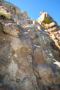
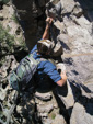
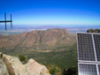
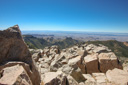
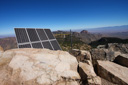
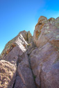
At the top of the switchbacks (Pinnacles Pass), we stopped for a lunch break and then made our way towards the Emory Peak spur trail—about 0.1-mile from the saddle. The 1-mile trail to Emory Peak cuts off to the right side of the Pinnacles Trail, climbing steeply towards the summit—the last 25 feet of which require a vertigo-inducing scramble up an exposed rock face—but the view is fantastic in all directions. It took a little confidence building, but I eventually made it to the summit—where I promptly sat down near one of the not so inspiring antenna. Other hikers were not at all shaken by the sheer cliffs and claustrophobically small summit, but I was experiencing flashbacks of Borah Peak—at least I made it to Emory’s summit—it was getting back down that worried me.
Thankfully, we found a not so death-defying route back down from the summit and eventually arrived safely back at the base of the climb. From that point, we retraced our steps back to the main trail where we then decided to take a right and head for Boot Canyon rather then returning to the Basin via the Pinnacles Trail.
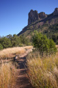
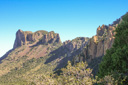
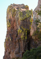
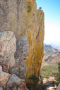
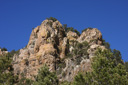
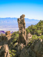
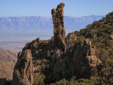
The trail, now called the Boot Canyon Trail, winds through Boot Canyon for 2.8 miles before reaching the South Rim. The “Boot” formation, for which the canyon is named, is located above the junction of Boot and Juniper canyons—you can’t miss it. This volcanic spire, shaped like an upside-down cowboy boot, is a unique formation in a scenic canyon—a sight we would have missed if we would have turned around after Emory Peak.
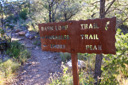
Soon after viewing the “Boot” formation, we caught the 0.8-mile Colima Trail—a shortcut between the Pinnacle Trail and Laguna Meadow Trail. This shortcut makes it possible to complete this loop without hiking all the way to the South Rim—a destination best served by backpacking.
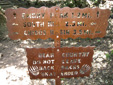
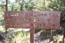
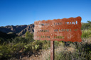
The Colima Trail eventually intersects with the Laguna Meadow Trail at a junction 4.6 miles from the Basin Trailhead—your destination and end of the hike. Take a right at the junction and follow the Laguna Meadow Trail towards the intersection with the Blue Creek Trail—located a short distance above Laguna Meadow. Near the intersection, you will find a plaque that describes the Blue Creek Canyon fire—after reading the sign, take a seat on the bench and enjoy the view of the canyon.
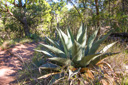
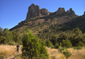
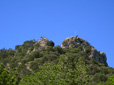
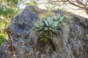
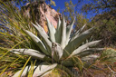
As you descend the talus slopes below Emory Peak, be sure to turn around for the views of the mountain—the vista is impressive. In addition, look among the scattered boulders for the southern-most stand of quaking aspens in the United States—not to mention the huge specimens of Havard agave that cling to the rocks.
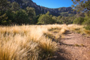
Descending farther into the Basin, the trail passes over black volcanic soil as it exits the grassy flats of Laguna Meadow—juniper and pinyon dot the landscape.
Eventually, after several miles of hiking, the familiar view of the Window and Casa Grande come into view, signifying the proximity of the Chisos Mountain Lodge—a welcome sight after 12 miles. We took our final steps on the Laguna Meadow Trail at 6:00 pm, for a roundtrip hiking time of 8 hours. The many trails at Big Bend offer the hiker a variety of choices, and the Chisos Basin/Emory Peak area grant those who venture into its heart the opportunity to get up close and personal with some of the most spectacular scenery in Texas. Including Emory Peak in your plans assures that you will see some of the best scenery in the park—the grandeur of Big Bend country awaits.
 |
 |
 |
 |
 |
 |
 |
 |
 |
 |
 |
 |
 |
 |
 |
 |
 |
 |
 |
 |
 |
 |
 |
 |
 |
 |
 |
 |
 |
 |
 |
 |
 |
 |
 |
 |
 |
 |
 |
 |
 |
 |
 |
 |
 |
 |
 |
 |
 |
 |
 |
 |
 |
 |
 |
 |
 |
 |
 |
 |
 |
 |
 |
 |
 |
 |
 |
 |
 |
 |
 |
 |
 |
 |
 |
 |