Wheeler Peak
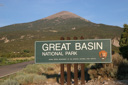
Great Basin National Park, Nevada

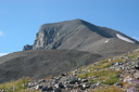
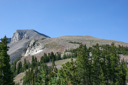
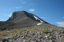
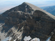
Wheeler Peak, located in Great Basin National Park, looms high above the vast area of sagebrush covered valleys and sawtooth mountain ranges. It is the highest summit in the Snake Range and the second highest mountain in the state, at 13,063 feet it is just a mere 81 feet shy of taking the state highpoint—Boundary Peak, 13,143 feet high, claims that honor. A truly remote mountain peak, Wheeler is far removed from city life—the nearest city is Ely, 67 miles to the west.
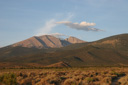
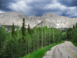
Our first view of Wheeler Peak came while driving along US Route 93 late in the afternoon on July 20, 2006. The view fueled our excitement to reach the summit, but for now, we were headed for Ely, Nevada, destined for a hot meal and a hotel room.
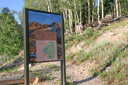
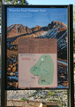
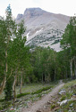
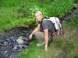
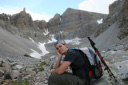
The next morning we awoke at 4:00 am, jumped in the car and drove towards our goal—it is important to get an early start on this hike, because of the risk of afternoon thunderstorms. We arrived at the Summit Trailhead Parking Area, located near the end of the 12 mile long Wheeler Peak Scenic Drive, at 7:00 am ready to start our adventure. The morning air was crisp and filled with the smell of pine, and the blue sky above offered the promise of a perfect summer day. A quick glance at the GPS told us that our starting elevation was 10,161 feet, for an elevation gain of 2,902 feet in 4.3 miles.
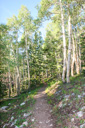
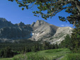
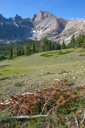
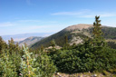
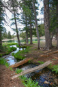
From the parking area, the trail heads through aspen groves along the southern slopes of Bald Mountain towards Stella Lake. Openings in the forest canopy provide amazing views of Jeff Davis and Wheeler Peaks. We enjoyed the views from the trail, stopping occasionally to watch mule deer make their way up the steep ridge, and then after 15 minutes of hiking had passed, we reached the 1 mile mark and the junction with the Alpine Lakes Trail—just 3 miles to go. The Alpine Lakes Trail joins from the left, just continue hiking a short distance (0.2 miles), and then turn sharply right on the signed Wheeler Peak Trail.
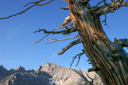
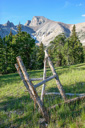
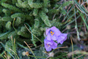
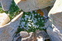
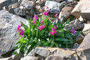
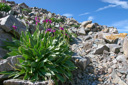
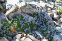
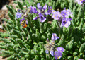
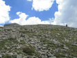
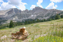
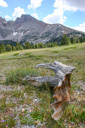
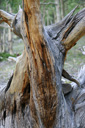
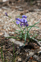
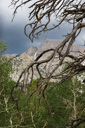
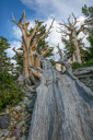
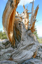
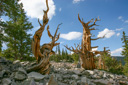
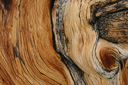
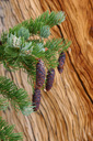
The trail then climbs the southeast slopes of Bald Mountain, a gentle hike along the hillside through a broad meadow and groves of limber pine and Englemann spruce. In July, the month of our hike, the wildflowers were abundant—Indian paintbrush, penstemon, primrose, and buckwheat were all flowering. Before long, the trail begins to climb the ridge—note that the trees are now beginning to look gnarled and many of the branches are flagged. This stunted condition is due to high altitude winds, as the trees are the last vestiges of the forest for you are now gaining ground towards treeline. You may have heard the term krumholz zone used to describe these twisted trees, and this is a fitting term as krumholz is German for “crooked wood.”
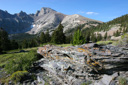
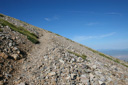
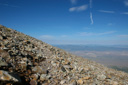
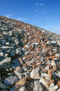
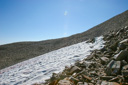
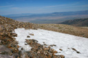
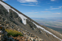
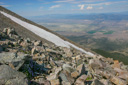
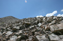
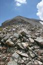
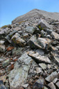
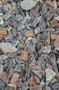
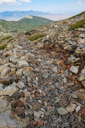
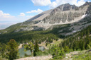
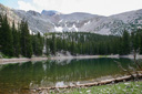
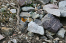
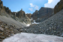
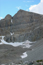
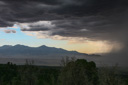
Beyond the krumholz zone is the boulder field, a sea of rock that you must navigate in order to reach the summit—we decided to rest at this point and have a snack before beginning the uphill battle, the time was 8:11 am. After our brief rest, we continued hiking, admiring the views along the remainder of the trail, which are outstanding. The clear, shallow waters of Stella Lake are visible to the east, and desert valleys dotted with green stretch to the eastern and western horizon. The only sounds are the rattle of footsteps on boulders, much like the sound of walking on ceramic, and the labored breathing that comes with high altitude. A reminder that from here on out, high altitude weather is a constant threat and one must be vigilant about watching the skies for the threat of thunderstorms—a potentially deadly occurrence thanks to lightning strikes. Luckily for us, the skies were as clear and as blue as possible, but storms can pop up from nowhere, so we stayed our course, hoping to be heading down from the summit before noon.
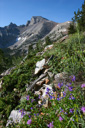
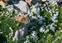
As the final ascent up Wheeler Peak steepened, I found myself thoroughly enjoying the brief stops made in order to photograph the alpine flowers and the rocky trail—I was especially excited to see sky pilot, Parry primrose, and cushion phlox adorning the high altitude quartzite rock.
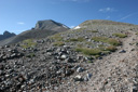
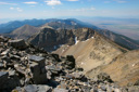
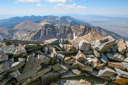
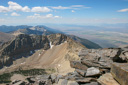
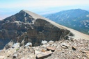
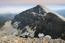
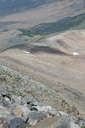
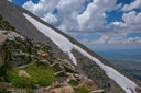
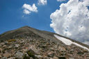
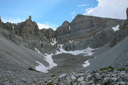
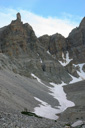
After lunch, we followed the trail as it climbed south up the broad north ridge of Wheeler Peak, where at one point the trail levels out allowing a short respite from the steep climb. We were now at almost 12,000 feet, and shortly after the level portion begins it ends, and the trail steepens even more as you begin the final ascent. The views at this point are breathtaking, as is the altitude, but all effort is worth it as you gaze down the entire 7,000 foot sweep of the west ridge to Spring Valley far below. Wheeler Peak does not have a false summit, so the highest point that you can see is truly your goal and it is reached with little notice, unless your hiking partner has beat you to the summit and keeps peaking over the ridge to gauge your progress.
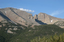
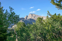
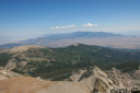
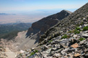
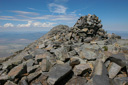
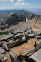
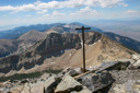
The summit of Wheeler Peak is spectacular, spread out before you is 360-degree view, with sheer drop offs in all directions. We had reached the top of this beautiful mountain in less than four hours -we were standing on the top of the Snake Range at 10:46 am. The summit itself is composed of huge slabs of quartzite rock, interspersed with smaller boulders. The view is particularly spectacular from the eastern end of the summit, where you can look out towards Jeff Davis Peak (12,771 feet) which rises high above the cirque formed by the Wheeler Glacier. The sheer drop-off to the west is intimidating. In addition, the view to the south is just as magnificent. Dominating this view is Baker Peak (12,298 feet) which stands above yet another beautiful amphitheater of sheer cliffs.
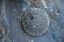
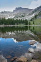
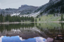
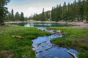
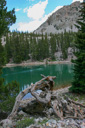
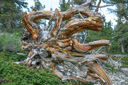
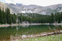
After exploring the summit thoroughly, we made our way to the rock shelter that housed a mail box containing the summit register—we signed the log at 11:16 am, and then planned our course of attack for the descent. The easy choice would have been to head back the way we came, most likely putting us at our car in two hours, but a brief look at our map gave us another idea. We decided to follow the summit trail back down the mountain as far as the Alpine Lakes Loop Trail, and then catch that trail in order to see the two alpine jewels known as Stella and Teresa Lakes. From there we could finish our tour of Great Basin National Park by joining the Bristlecone-Glacier Trail. This would add a few miles onto our original hiking plans, but it sounded like a fun way to end the day.
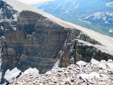
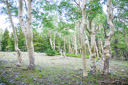
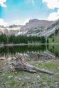
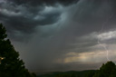
We made our way past the beautiful lakes, stopping at Teresa Lake for a quick foot soak, and then we climbed the ridge leading to the grove of ancient Bristlecone pines. Our last bit of energy was spent climbing to the foot of Wheeler Glacier where we could look up the face of the mountain we had just climbed. The day was coming to an end, and the skies were starting to darken with the threat of storms, so we quickened our pace in an effort to reach our car before bad weather reached us. Thankfully, with the sound of thunder rumbling in the distance, we made it to our car without one raindrop falling on our heads.
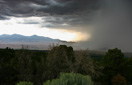
My watch was nearing the five o’clock mark when we broke into the cooler at our car—it had been a beautiful day of hiking, a perfect summit, and most importantly, a great adventure. As we drove back down the scenic drive road, we looked in the rear view mirror for one last glimpse at the massive mountain, storm clouds were now racing over its summit and soon the rain let loose. We parked the car at an overlook and watched the storm unfold over the desert, thankful that it had waited to unleash its fury until our hike was over. Great Basin National Park might not be the most accessible park, but it is by far now one of our favorites, thanks to a beautiful day on the slopes and summit of Wheeler Peak.
 |
 |
 |
 |
 |
 |
 |
 |
 |
 |
 |
 |
 |
 |
 |
 |
 |
 |
 |
 |
 |
 |
 |
 |
|
|
|
|
 |
 |
 |
 |
 |
 |
 |
 |
 |
 |
 |
 |
 |
 |
 |
 |
 |
 |
 |
 |
 |
 |
 |
 |
 |
 |
 |
 |
 |
 |
 |
 |
 |
 |
 |
 |
 |
 |
 |
 |
 |
 |
 |
 |
 |
 |
 |
 |
 |
 |
 |
 |
 |
 |
 |
 |
 |
 |
 |
 |
 |
 |
 |
 |
 |
 |
 |
 |
 |
 |
 |
 |
 |
 |
 |
 |