
Mount Rogers—Highpoint of Virginia
Mount Rogers National Recreation Area
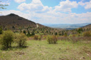
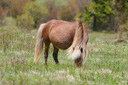
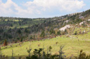
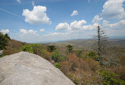
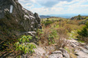
Mount Rogers, the highest point in the state of Virginia at 5,729 feet, boasts among its accolades wide sweeping vistas reminiscent of the western USA, diverse plant and animal life, the opportunity to scramble up huge volcanic boulders, amazing scenery, and of course, the wild ponies.
The most scenic route to the top, in our opinion, involves hiking a combination of trails that begin at Grayson Highlands State Park. The park is adjacent to the Mount Rogers National Recreation Area in the Jefferson National Forest, and it is here that you will access the Rhododendron Trail—the first trail on your way to claiming bragging rights for summiting the highest mountain in Virginia.
At a height of over 5,000 feet, Mount Rogers is among the small list of mountains in the Blue Ridge chain that exceed that number—from northern Georgia to southern Pennsylvania only seven peaks rise above that threshold. In addition, while quite a few peaks in the Appalachians outside of Virginia are higher, Mount Rogers can claim to be the highest of the state highpoints east of South Dakota that lacks a road to its summit.
The route we chose to follow to this lofty summit involved a roundtrip hike of 8 miles with an elevation gain of 1,510 feet. As mentioned before, we set off on the Rhododendron Trail, picked up the Appalachian Trail to the Wilburn Ridge Trail, and then finally hiked the rest of the way to the summit via the Mount Rogers Trail. Hiked in this manner it should take the average hiker approximately 4 to 6 hours to complete the circuit—we clocked in at just under 7 hours.
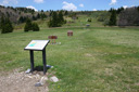
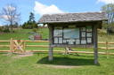
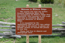
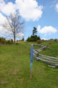
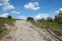
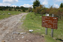
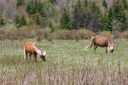
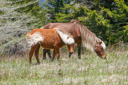
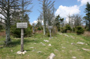
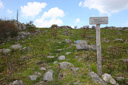
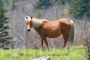
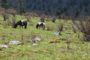
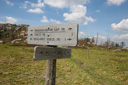
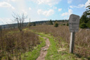
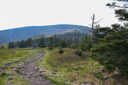
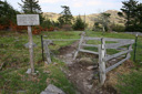
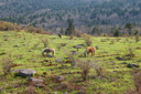
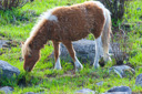
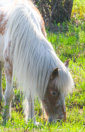
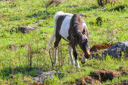
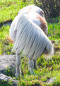
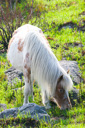
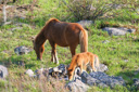
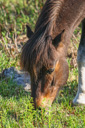
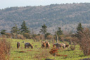
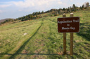
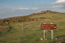
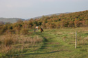
We arrived at the Massie Gap Parking Lot, located in Grayson Highlands State Park, at a little after 1:00 pm ready and excited to begin our adventure. From the parking area we headed north across a grassy field towards the informational signs and the gate that marks the trailhead—the Rhododendron Trail heads uphill from this point, passing by a scenic split rail fence before intersecting with the Appalachian Trail (AT) in 0.5 miles. The Appalachian Trail is identified by white paint blazes on rocks and trees—follow it north towards the summit. Shortly after setting off on the AT, we caught our first glimpse of the wild ponies—two ponies, perhaps a mother and foal, were grazing in a grassy field. We stopped to watch them for several minutes before pushing on, and we hoped they would not be the only ponies we would see on our hike. Just after leaving the ponies (0.5 miles from the AT junction), we reached the boundary of Grayson Highlands State Park, which is marked by a fence complete with a turnstile for easy passage. We crossed over into the Mount Rogers National Recreation Area, signed the trail register and continued on our way towards the highpoint.
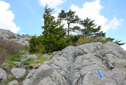
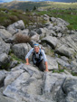
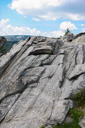
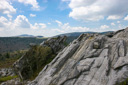
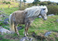
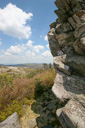
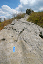
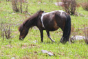
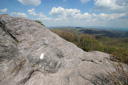
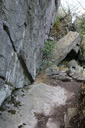
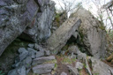
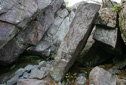
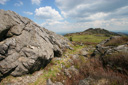
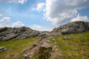
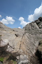
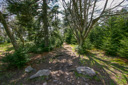
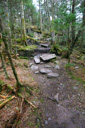
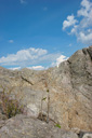
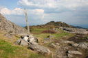
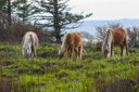
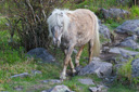
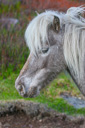
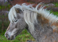
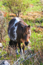
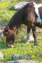
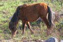
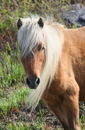
Uphill and shortly after leaving the trail register you will come to a trail junction—from this point you have a choice of two trails, the Appalachian Trail or the Wilburn Ridge Trail. If you would like an easier route to the summit, take a right and continue following the AT, but if you want to add some adventure to your hike, take a left and follow the Wilburn Ridge Trail for some exciting rock climbing. Regardless of which trail you choose at this point, you will end up at the same place—the trails meet again a little farther (0.6 miles) up the mountain. We opted to add some spice to the hike by following the Wilburn Ridge Trail—a good choice as it provided beautiful vistas and a fun route—the fun comes from climbing the jumble of boulders and weaving around and through the different rock formations, which are marked with blue blazes. Furthermore, Wilburn offers some of the best pony viewing opportunities on the mountain—we must have encountered at least 50 ponies, some of which are so artfully colored that you expect them to sprout a unicorn horn at any moment.
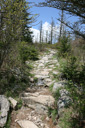
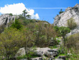
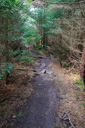
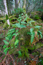
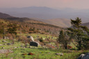
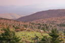
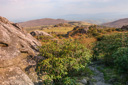
The next stop on the way to the summit is Rhododendron Gap, 2.5 miles from Massie Gap, where you will encounter magnificent views from the cliff tops. At this point you have now completed most of the elevation gain for the hike, but don’t get too complacent, there are still some steep sections yet to come. Once again on the Appalachian Trail, we continued to hike, winding downhill through the trees and past beautiful wildflowers such as trillium and trout lilies, passing through two more stiles before reaching the Thomas Knob Shelter. Approximately 5 minutes after passing the shelter, you will reach the junction of the Mount Rogers Trail—turn right and follow it 0.5 miles uphill to the summit.
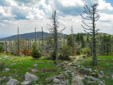
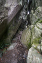
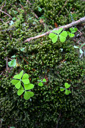
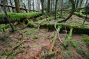
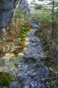
Atop Mount Rogers, you will find a fir-spruce forest reminiscent of a more northern climate. At the highest point grow northern hardwoods, red spruce, and mountain wood sorrel wildflower—a world that seems far removed from the relatively tame, wooded mountainside speckled with large boulders from which you just came. The summit lies within the Lewis Fork Wilderness Area, a place that supports stands of Fraser fir, an evergreen that grows no farther north than the crest zone of Mount Rogers.
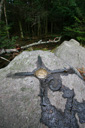
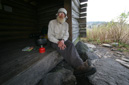
We made our way towards the summit, passing through the cool, mossy forest in true amazement—admiring the lush ground cover, complete with clovers, along the way. When we reached the highpoint there were no views to be had, obviously, since it is covered in a thick spruce-fir forest, but the verdant surroundings more than make up for the lack of sweeping vistas. After exploring the summit, we located the USGS benchmark in a rocky outcrop off to the left of the trail, posed for a group photo, and sat down to enjoy a well-deserved snack break—it was 4:00pm, 3 hours from the start of our hike. We rested and enjoyed the summit for about 15 minutes before beginning our return journey.
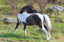
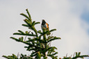
Our trek back to the car was just as enjoyable as the ascent despite the familiar scenery, the repetitiveness broken by a visit with an AT Southbounder by the name of Rambo Ron, who entertained us with some amazing trail stories. Plus, we had several more encounters with the wild ponies. In particular, we came across a rambunctious group frolicking very near the trail just below Wilburn Ridge—one of which sauntered right up the trail towards me looking for a handout—too funny. We varied our descent by taking part of the Wilburn Ridge Trail and a previously unhiked portion of the AT back down. Along the way we spotted several eastern towhees, some of which were kicking around in the leaves foraging for insects while others were content to perch atop the trees.
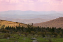
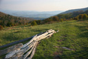
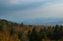
The sun was starting to color the grassy balds and the mountainside a golden orange when we reached the Rhododendron Trail once again. In the golden glow of late afternoon, we made our way back to the car, taking one last look over our shoulders towards the ridge and the spectacular scenery that we were about to leave behind. It had been a perfect day for a climb, and we had enjoyed every second of our journey—all that was left to do now was to sprint across the grass to the parking lot where our car and a cooler of ice-cold sodas awaited! We popped open an icy beverage, marked the time at 7:26 pm, and toasted Mount Rogers—cheers and thanks for a memorable day!
 |
 |
 |
 |
 |
 |
 |
 |
 |
 |
 |
 |
 |
 |
 |
 |
 |
 |
 |
 |
 |
 |
 |
 |
 |
 |
 |
 |
 |
 |
 |
 |
 |
 |
 |
 |
 |
 |
 |
 |
 |
 |
 |
 |
 |
 |
 |
 |
 |
 |
 |
 |
 |
 |
 |
 |
 |
 |
 |
 |
 |
 |
 |
 |
 |
 |
 |
 |
 |
 |
 |
 |
 |
 |
 |
 |
 |
 |
 |
 |
 |
 |
 |
 |
 |
 |
 |
 |
 |
 |
 |
 |
 |
 |
 |
 |