
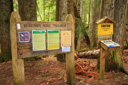
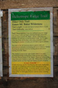
Heliotrope Ridge Trail
Mount Baker-Snoqualmie National Forest, Washington

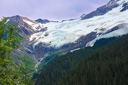
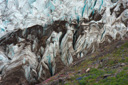
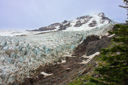
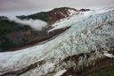
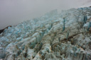
Alpine wonders await those who trek the 6-mile roundtrip Heliotrope Ridge Trail—climbing through captivating forest, meadows filled with wildflowers, past waterfalls and across thrilling creeks, the trail eventually provides an intimate view of the Coleman Glacier headwall, complete with menacing crevasses and icefalls that groan and creak as they make their way down Mt. Baker’s west flank.
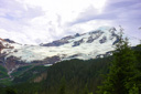
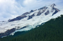
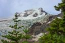
Mount Baker, the third highest peak in Washington, reaches the lofty height of 10,781 feet—its slopes blanketed with twelve named glaciers. One of which, the Coleman Glacier, is sure to delight all but the most seriously jaded hiker—within a few hours after leaving the trailhead, you will be admiring this living glacier.
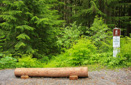
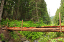
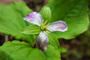
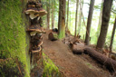
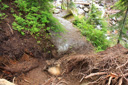
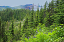
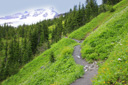
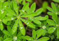
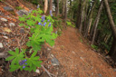
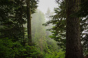
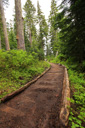
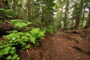
The Heliotrope Ridge Trail descends from the parking lot, dropping immediately into the forest and across Grouse Creek via a log bridge with a railing on one side—a somewhat intimidating experience, especially when you look down into the creek to see the old collapsed bridge being battered by the icy water. Once across the bridge the trail starts climbing through old-growth forest and shade-loving flowers such as Queen’s cup, western trillium, and Indian pipe before entering the Mount Baker Wilderness. Continue climbing the steep ascent generally on a muddy, rooty, avalanche damaged trail before leveling out at the 0.5-mile mark—finally, views open to the north.
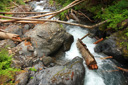
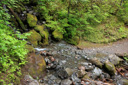
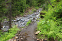
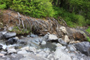
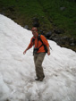
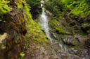
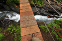
Beyond the 1-mile mark, the hike crosses several unbridged, potentially hazardous, streams—the depth and force of the streams fluctuate depending on snowmelt, time of day, and rainfall. Take note folks, a stream crossed with little difficulty in the morning can become a raging torrent by afternoon—after all, these are the “Cascades” and you need to be prepared to get your feet wet. The first stream crossing, below a wispy waterfall, poses little difficulty, but within the next 0.5-mile two more crossings will be encountered—both of which will likely have you planning your route of attack. Trekking poles are invaluable in these situations, allowing you to stabilize your body as you attempt to stay dry while rock-hopping across the creek—an exercise that is not an option when the water is high. Less experienced hikers might want to wait until late summer, when the snowmelt has slowed, before attempting this trail.
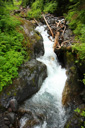
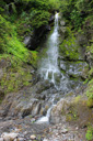
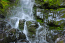
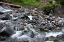
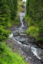
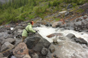
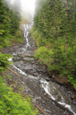
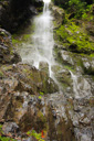
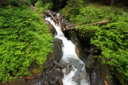
Continue your zigzag ascent through the forest towards the waters of Kulshan Creek—this second major stream crossing is a little trickier—first, descend to the creek along a dirt embankment and then search for safe passage across the boulders. From the stream, the well-graded trail climbs another 0.4-mile to an off trail viewpoint of 150-foot Kulshan Falls—a lovely four tiered cascade.
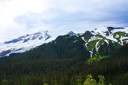
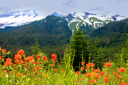
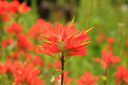
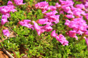
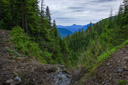
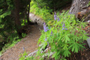
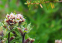
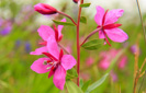
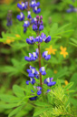
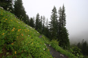
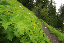
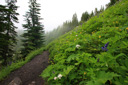
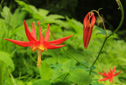
Leaving the forest and the rushing waters of Kulshan Creek behind, the trail views open up and massive Mount Baker dominates the landscape—a view slightly obscured by clouds during our trek. As the forest gives way to open meadows, the trail passes through stands of pink and white mountain heather, penstemon, paintbrush, daisy, marsh marigold, lupine and valerian (heliotrope)—welcome to Heliotrope Ridge.
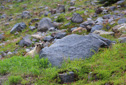
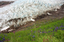
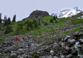
Where the climber’s route diverges right, stay on the trail to Glacier Overlook for an easy 0.5-mile hike to viewpoints above the foot of the glacier—easy accept for one last stream crossing. The trail enters a moraine landscape, cut by braids of Heliotrope Creek—the source of the last, sometimes treacherous, creek crossing. Plan on getting your feet wet in icy-cold, fast moving waters—there are no defined crossing places, just search out the route that suits you best and then take your time. Once across this last obstacle, the Coleman Glacier is within your grasp—follow the rocky path past marmot dens to your goal.
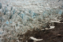
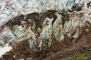
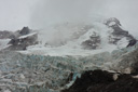
In just a few more steps you will find yourself standing on the hemlock-lined, flower-strewn ridge of the Coleman Moraine, below are the jagged deep blue seracs of the Coleman Glacier’s towering ice, above rises the snow-capped dome of Mount Baker—easily one of the best views in the state for the effort. A view that at times can be fleeting—after just a taste of the jaw-dropping view, clouds rolled in and the mountain and its glacier disappeared from sight. Such was our luck the day we hiked the Heliotrope Ridge Trail—hopefully, you will find yourself admiring the beauty of Mount Baker under fair skies.
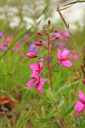
As you lunch and/or rest on the edge of the moraine, look around for the pink blooms of broadleaf willowherb—a flower that provides a great foreground for photographs of the massive ice field. Don’t be tempted to venture onto the glacier—many people have died trying to cross the icy landscape, best to view it from afar. Before retracing your steps, savor the view (if there is one) and take pride in a hike well-done—over the course of your adventure you have climbed three miles, gaining 1900 feet in the process—check another spectacular hike off your list and then make your way back to the trailhead.
 |
 |
 |
 |
 |
 |
 |
 |
 |
 |
 |
 |
 |
 |
 |
 |
 |
 |
 |
 |
 |
 |
 |
 |
 |
 |
 |
 |
 |
 |
 |
 |
 |
 |
 |
 |
 |
 |
 |
 |
 |
 |
 |
 |
 |
 |
 |
 |
 |
 |
 |
 |
 |
 |
 |
 |
 |
 |
 |
 |
 |
 |
 |
 |
 |
 |
 |
 |
 |
 |
 |
 |